
Too often, companies take your payment and disappear, leaving you waiting for updates and navigating impersonal support channels when questions arise. We know this because we have been there! At 9 Line Flight Systems, we make sure that never happens. We provide direct, personalized assistance from your initial inquiry through delivery, training, and ongoing support. You’re not just another transaction. You’re a valued partner, and we’re committed to your success every step of the way. Experience the difference, reliable communication, expert guidance, and a team that truly cares about your results.
Let's find the right fit for your project together!
Shop our customized bundles below & if you still have questions just ask!
Groundbreaker Pack
For ambitious startups, municipal teams, or small survey firms taking their first leap into drone mapping. The Groundbreaker Pack is designed to eliminate barriers with no technical headaches. Just a streamlined, professional toolkit to help you break new ground and deliver results from day one.
Bundle Includes:
-
WingtraRAY drone
-
Survey24 Payload
-
Wingtra ESSENTIAL flight planning software


ModelPro Jumpstart
Built for growing survey businesses, construction teams, and public agencies who are ready to scale up. ModelPro Jumpstart adds industry-leading photogrammetry software, so you can process big datasets, deliver high-quality maps, and stay ahead of client expectations.
Bundle Includes:
-
WingtraRAY drone
-
MAP61 Payload
-
Pix4D Matic Subscription
PrecisionFlight Suite
Engineered for professional surveyors, engineers, and inspection specialists who need top-tier accuracy and detail. PrecisionFlight Suite is your toolkit for complex urban mapping, infrastructure, or inspection jobs where ultra-high-res imaging and seamless CAD integration are critical.
Bundle Includes:
-
WingtraRAY drone
-
SURVEY61 Payload OR MAP61 Payload
-
Pix4D Matic and Pix4D Survey Subscription


AeroStructure Kit
Perfect for advanced users focused on detailed 3D modeling, digital twins, or urban environments. The AeroStructure Kit’s oblique imaging and extra batteries let you tackle complex sites and deliver high-res 3D models all in a single day’s work.
Bundle Includes:
-
WingtraRAY drone
-
MAP61 Payload
-
Wingtra ESSENTIAL flight planning software
-
Extra Flight Battery set
OpsCenter Bundle
Tailored for multi-site operators, large engineering firms, and government agencies managing complex, high-volume projects. OpsCenter Bundle offers advanced 3D planning, secure cloud storage, and the MAP61 payload to ensure every deliverable is top-tier.
Bundle Includes:
-
WingtraRAY drone
-
MAP61 Payload
-
WingtraCLOUD Pro


Pinnacle Ops Kit
For organizations that refuse to compromise. Pinnacle Ops Kit is the all-in, end-to-end solution for large contractors, government agencies, and enterprise teams. With top-tier hardware, unlimited cloud processing, advanced ground control, and every operational upgrade, you’re equipped to scale, automate, and dominate any mapping challenge.
Bundle Includes:
-
WingtraRAY drone
-
MAP61 Payload
-
WingtraCLOUD UNLIMITED
-
WingtraCARE
-
WingtraGROUND
-
Premium Tablet
-
WingtraRAY Parachute System
-
WingtraRAY Heavy Flyer Add-on
LIDAR Apex Suite
For the most demanding mapping professionals like survey companies, engineering giants, and government agencies tackling massive infrastructure or environmental projects. LIDAR Apex Suite delivers airborne LIDAR, unlimited processing, and every operational upgrade for dense point clouds, complex terrain, and high-stakes deliverables.
Bundle Includes:
-
WingtraRAY drone
-
Wingtra LIDAR Payload
-
WingtraCLOUD Pro flight software (annual)
-
LiDAR 360 software
-
WingtraRAY Heavy Flyer add-on
-
WingtraRAY Parachute System


EcoSurvey Set
Designed for agronomists, environmental consultants, and research teams who demand advanced multispectral analytics. ExoSurvey Set is engineered for precision agriculture and land management, unlocking crop health, environmental monitoring, and resource optimization at scale.
Bundle Includes:
-
WingtraRAY drone
-
MicaSense RedEdge-P Payload
-
WingtraRAY Heavy Flyer add-on
-
WingtraRAY Parachute System
SkyStamina Pack
Built for contractors and elite operators who need maximum uptime, safety, and operational stamina. The SkyStamina Pack maximizes your ability to fly longer, cover more ground, and deploy confidently in demanding environments.
Bundle Includes:
WingtraRAY drone
MAP61 Payload
WingtraCLOUD Pro Plan
WingtraRAY Heavy Flyer add-on
WingtraRAY Parachute System


Product Descriptions

Since each bundle is fully customizable to you and your project, reach out to today so we can get you the best price for exactly what you need!
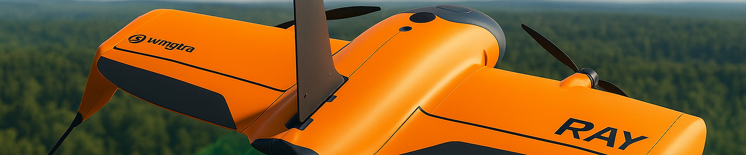
WingtraRAY Drone
The WingtraRAY is the gold standard for professional aerial mapping and surveying. With integrated PPK (Post-Processed Kinematic) for centimeter-level accuracy, a rugged OS & suite of apps, and a bright, field-ready tablet, you’re equipped for demanding projects right out of the box. The included carrying sleeve and dual battery set mean you’re mobile, protected, and ready for back-to-back missions with no downtime, no drama. This drone is engineered for reliability, speed (up to 60 mph), and massive coverage which makes it perfect for professionals who can’t afford to miss a detail.
Capabilities:
-
PPK for survey-grade accuracy
-
Up to 60 mph flight speed, 6000 acres/day coverage
-
Automated flight planning & execution
-
Rugged design, easy field transport
-
All-in-one package: drone, tablet, batteries, sleeve
Extra Flight Battery Set
Never get grounded. This extra set of high-capacity batteries keeps your operations running longer which is more than ideal for big jobs, remote sites, or when you need to push through multiple flights in a day. Fast-swap design means zero workflow interruptions.
Capabilities:
-
Doubles flight endurance
-
Quick-swap for minimal downtime
-
Essential for large sites or back-to-back missions
Premium Tablet
The premium tablet is built for fieldwork because it’s big, bright, and rugged. A 10” HD screen keeps your flight planning and data review crystal clear, even under harsh sunlight. Two high-capacity batteries (one spare) mean you’re never out of juice, no matter how long the mission.
Capabilities:
-
10” high-brightness HD display
-
Field-ready, rugged build
-
Includes spare battery for all-day use
WingtraRAY Heavy Flyer Kit
For true power users, the Heavy Flyer Add-on is the ultimate operational upgrade. With a hard shell pilot box, six batteries, charging gear, and critical spares, you’re ready for marathon days and massive sites. No more waiting for a charge. Just fly, swap, and repeat.
Capabilities:
-
6 batteries, pilot box, charging gear, tools, spares
-
Enables continuous, high-volume operations
-
Built for large sites and all-day missions
Survey24 Payload
The Survey24 payload is your go-to for high-efficiency, professional-grade aerial surveys. Its 24 MP RGB sensor delivers crisp, detailed imagery ideal for mapping, volumetrics, and orthomosaic creation. Lightweight and fast, it’s perfect for projects where speed and solid resolution matter like construction, land management, and infrastructure.
Capabilities:
-
24 MP high-resolution RGB imaging
-
Fast data capture for large areas
-
Optimized for mapping, orthomosaic, and volumetric surveys
-
Lightweight, easy to swap
Wingtra LIDAR Payload
The Wingtra LIDAR Payload brings true 3D mapping to the skies. With a top-tier LIDAR scanner, GNSS, IMU, and a perpetual license, you can capture high-density point clouds and model complex terrain, even in dense vegetation or challenging environments.
Capabilities:
-
High-precision airborne LIDAR scanning
-
Includes GNSS, IMU, full mounting kit
-
Perpetual software license for unlimited use
-
Ideal for topography, vegetation, and infrastructure mapping
WingtraRAY Drone
The WingtraRAY is the gold standard for professional aerial mapping and surveying. With integrated PPK (Post-Processed Kinematic) for centimeter-level accuracy, a rugged OS & suite of apps, and a bright, field-ready tablet, you’re equipped for demanding projects right out of the box. The included carrying sleeve and dual battery set mean you’re mobile, protected, and ready for back-to-back missions with no downtime, no drama. This drone is engineered for reliability, speed (up to 60 mph), and massive coverage which makes it perfect for professionals who can’t afford to miss a detail.
Capabilities:
-
PPK for survey-grade accuracy
-
Up to 60 mph flight speed, 6000 acres/day coverage
-
Automated flight planning & execution
-
Rugged design, easy field transport
-
All-in-one package: drone, tablet, batteries, sleeve
WingtraGROUND Kit
WingtraGROUND is your field-proven GNSS solution for ground control and RTK workflows. With a robust set of receivers, tripods, targets, and rugged transport case, you can set up, mark, and verify your survey sites with absolute precision.
Capabilities:
-
Complete GNSS base/rover kit for RTK/PPK workflows
-
All hardware included: tripods, targets, nails, hard case
-
Streamlined field setup and transport
WingtraRAY Parachute System
Safety is non-negotiable, and the WingtraRAY Parachute System delivers. Designed for operations over people or sensitive sites, this add-on deploys instantly in emergencies, protecting your investment and those below. A must-have for urban, industrial, or public-facing projects.
Capabilities:
-
Emergency parachute deployment
-
Manual trigger for instant response
-
Enhances safety for BVLOS and populated area flights
SURVEY61 Payload
The SURVEY61 payload is all about precision and detail. With a 61 MP full-frame sensor, it captures ultra-high-res imagery for the most demanding survey, inspection, and engineering projects. Perfect for tight tolerances, fine feature mapping, and when every pixel counts.
Capabilities:
-
61 MP full-frame RGB imaging
-
Ultra-detailed data for critical applications
-
Ideal for inspection, engineering, and high-res mapping
-
Superior low-light and dynamic range
MAP61 Payload
The MAP61 payload is the ultimate in detail and flexibility. With a 61 MP full-frame sensor in an oblique configuration, it captures comprehensive 3D data like vertical and angled shots for true-to-life models. The included mount, stabilizer, and damping system ensure sharp, clean data even in challenging conditions.
Capabilities:
-
61 MP full-frame sensor, oblique & nadir angles
-
Captures vertical and side imagery for complete 3D models
-
Includes stabilizer and damping for vibration-free results
-
Best for digital twins, complex topography, and urban mapping
MicaSense RedEdge-P Payload
The MicaSense RedEdge-P is the gold standard for agricultural and environmental monitoring. Its multispectral imaging captures five bands plus high-res RGB, unlocking advanced crop analytics, plant health, and resource management at scale.
Capabilities:
-
Multispectral + RGB imaging (5 bands)
-
Advanced crop health and environmental analytics
-
Essential for precision agriculture, forestry, research
Pix4D Matic Subscription
Pix4Dmatic is purpose-built for large-scale, professional photogrammetry. It slashes processing times for huge datasets, delivers survey-grade outputs, and integrates seamlessly with Wingtra data. If you want fast, accurate 2D/3D maps, digital twins, and elevation models from massive projects, Pix4Dmatic is the industry’s top-tier solution.
Capabilities:
-
Lightning-fast photogrammetry processing for large datasets
-
Generates 2D/3D maps, DSMs, orthomosaics, point clouds
-
Survey-grade accuracy, seamless integration with Wingtra
-
Supports advanced outputs for engineering/CAD workflows
Pix4D Survey Subscription
Wingtra ESSENTIAL
Flight Planning Software
Wingtra ESSENTIAL is the brain of your operation. Plan, fly, and capture with a single, intuitive app that syncs across devices or runs fully offline. Automated flights, real-time geotagging, and support for global coordinate systems (WGS84, NAD83) mean you get precise data without the headaches. It’s built for pros who want efficiency and bulletproof results.
Capabilities:
-
All-in-one mission planning and flight control
-
Cross-device sync and offline operation
-
Automated geotagging in WGS84/NAD83
-
Streamlines workflow from planning to data capture
Pix4Dsurvey bridges the gap between photogrammetry and CAD. It transforms dense point clouds into actionable deliverables like breaklines, surfaces, and vector files ready for engineering teams. Perfect for surveyors who want to go direct from drone to design.
Capabilities:
-
Converts photogrammetry outputs to CAD-ready files
-
Extracts breaklines, surfaces, and vector features
-
Integrates with Pix4Dmatic and engineering workflows
-
Streamlines the survey-to-design pipeline
WingtraCLOUD UNLIMITED
WingtraCLOUD UNLIMITED is your enterprise-grade command center. Unlimited photogrammetry and LIDAR processing, 4TB of storage, and advanced workflows for massive projects. It’s the go-to for organizations who want to scale, automate, and never worry about limits.
Capabilities:
-
Unlimited photogrammetry/LIDAR processing
-
4TB cloud storage
-
Advanced 3D planning, checkpoints, and CRS workflows
-
Full-featured team collaboration
WingtraCLOUD Pro
WingtraCLOUD Pro is your all-in-one cloud HQ for 3D flight planning, checkpoint management, and CRS workflows. With 600 GB of secure storage, integrated WingtraGROUND guidance, and robust data management, it’s perfect for teams tackling complex, multi-site projects. Everything syncs, everything’s backed up, and collaboration is seamless.
Capabilities:
-
3D flight planning and checkpoint workflows
-
600 GB storage (annual billing)
-
Integrated ground control and CRS management
-
Secure, collaborative data access
WingtraCARE (from Year 2+)
WingtraCARE is serious peace of mind. This annual coverage (up to $100K/year) extends your warranty and protects you from user error, accidents, and hardware failures including all payloads and LIDAR. For pros, it’s a no-brainer: keep flying, stay covered, and avoid surprise costs.
Capabilities:
-
$100K/year coverage, includes user-fault and hardware failures
-
Covers all payloads and LIDAR
-
Continuous warranty for as long as you renew